Library of Congress
Places in Civil War History: Surveys of the Gulf Coast
Advertiser and register. [volume] (Mobile, Ala.) 1864-1865
Map: Our naval and military operations at a glance. The coast and land line of the rebellious states-the Union blockade of the Atlantic and Gulf coast-the rebel batteries on the Mississippi-the forts on the southern sea line
Department of the Gulf, Historical Sketch Maj. Gen. N.P. Banks, Civil and Military Administration in Louisiana
Fulfer, Richard J. A History of the Trials and Hardships of the Twenty-Fourth Indiana Volunteer Infantry. Indianapolis: Indianapolis Printing Co., 1913.
Images:
Barrancas / Pensacola:
Map: No. 2 plan of fort for Sta. Rosa Id., Pensacola Harbour, showing the general dimensions and the relations of the several parts of the work.
Photo: Confederate camp, Warrington Navy Yard, Pensacola, Florida, 1861
Mobile:
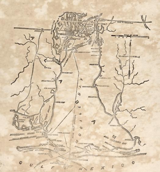
Map: Mobile Bay, Alabama
Map: Approaches to Mobile, Ala. 1864.
Map: Map of the defences of the city of Mobile. [1862-64]
Map: Mobile and vicinity
Map: Plan & view of the city of Mobile
Map: Rebel defences [sic] of Mobile shewing [sic] Union attack April 3rd-9th 1865 on Spanish Fort.
Map: Siege operations at Spanish Fort, Mobile Bay, by the U.S. forces under Maj. Gen. Canby.
Map: Siege operations at Spanish Fort, Mobile Bay, by the U.S. forces under Maj. Gen. Canby : captured by the Army of West Miss. on the night of April 8 & 9, 1865
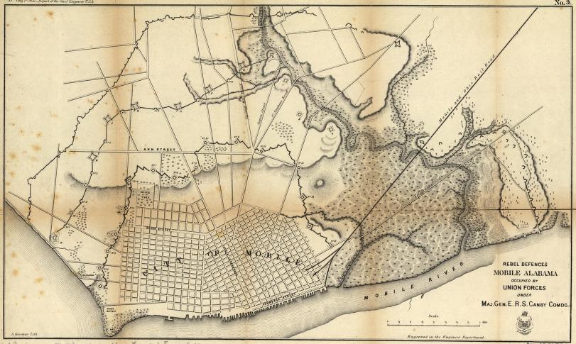
Map: Rebel defences, Mobile, Alabama, occupied by Union forces under Maj. Gen. E.R.S. Canby comdg.
Map: Capture of Mobile, Alabama